Tectonic plates for ks2
Tectonic plates definition
The crust can be considered of as the outermost layer of the earth. Tectonic plates are the segments that make up the crust’s many sections. These tectonic plates are moving in close proximity to one another.
What is the nature of the inner part of the earth?
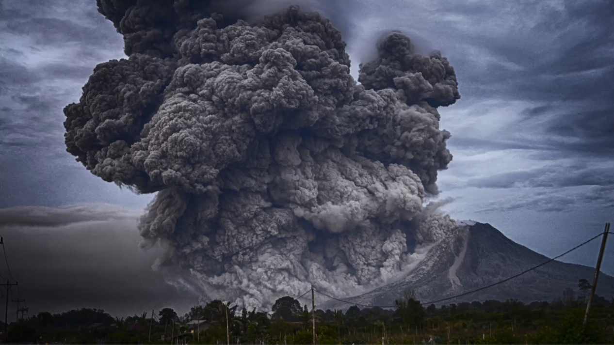
Geologists use several approaches to learn about the nature of the deep within the earth. Various types of rocks are brought to the earth’s surface during volcanic eruptions. Geologists learn about the inner workings of the planet by studying them.
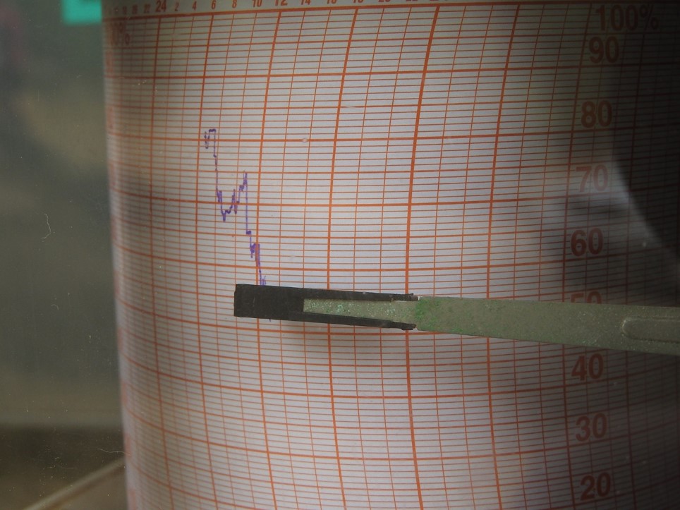
Examining earthquakes provides geologists with greater information about the nature of the inner component. Seismic waves are produced by massive rock movements within the earth during earthquakes. These waves reach the earth’s surface by passing through several strata of the earth. Seismometers are situated at various locations around the world. These seismometers automatically record seismic waves. Several layers of the earth’s crust experience varied rates of seismic wave transmission. Measuring those speeds can provide information about the earth’s core layers.
That knowledge has aided in the discovery that the earth’s interior is made up of multiple distinct layers.
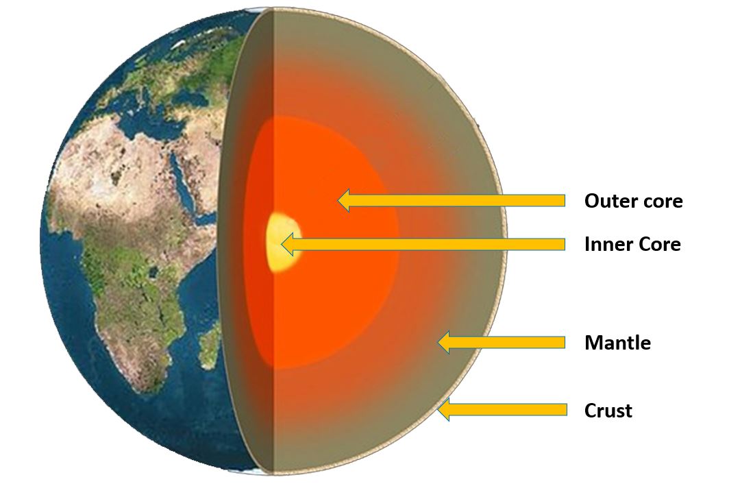
The earth’s interior is separated into three strata. These are the crust, mantle, and core, respectively.
Crust
The crust is the earth’s surface where life exists. It is a tiny layer when compared to the size of the earth. Mountains, plains, and oceans are all present in the crust. Its thickness changes based on your location. It can be discovered at the ocean’s floor.
There are about 5 kilometers of thickness. On land, it is around 35 kilometers thick. Rocks and soil make up the crust of the earth. It is made up of fundamental substances like oxygen, silicon, and aluminum.
Mantle
The mantle is located under the earth’s crust. It measures about 2900 kilometers thick. It is made up of rocks. These rocks are made up of oxygen, silicon, magnesium, and iron. The higher part is made up of solid rocks. Because of the extremely heated environment, the lower section is made up of molten rocks.
Core
The core is the earth’s innermost region. It has a thickness of around 3500 km. The top layer is formed of molten iron and nickel metals. The temperature in this area is between 4400 and 5000 degrees Celsius.
The bottom part of the core remains hard due to the high pressure. Its temperature exceeds 5000 oC, which is the same as the temperature on the sun’s surface.
How tectonic plates are formed
Tectonic plates do not form, but rather exist as part of the Earth’s lithosphere, which is the planet’s rigid outer shell. The lithosphere is made up of huge plates that move and interact with one another. The movement and interaction of tectonic plates is driven by forces deep beneath the Earth, particularly the movement of molten rock in the mantle. These pressures drive the plates to shift, collide, and split throughout time, giving rise to mountains, ocean basins, and other geological features. Plate borders are formed when two plates collide, and the movement and interaction of plates at these boundaries is responsible for numerous geological phenomena such as earthquakes, volcanoes, and the formation of new land masses.
Are tectonic plates part of the crust?
Tectonic plates are, in fact, part of the Earth’s crust. The crust of the Earth is the planet’s outermost layer, and it is separated into numerous enormous plates known as tectonic plates. These plates are made up of solid rock that is roughly 5-70 kilometers thick, depending on the location and type of plate. They are made up of both continental and oceanic crust.
The tectonic plates comprise the Earth’s solid outer shell, and they move and interact with one another along plate boundaries. These movements are caused by mantle processes and can result in geological phenomena like as earthquakes, volcanic eruptions, and the development of new land masses. Understanding the properties and behavior of tectonic plates is critical for comprehending the dynamics of the Earth’s crust as well as the processes that shape our planet over time.
.
Major tectonic plates
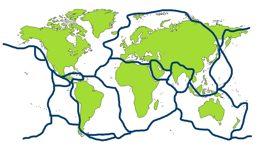
There are 7 major tectonic plates in the Earth crust. They are,
1. Eurasian tectonic plate
2. African tectonic plate
3. Indo-Australian tectonic plate
4. Antarctic tectonic plate
5. North American tectonic plate
6. Pacific tectonic plate
7. South American tectonic plate
Tectonic plates map/ Diagram tectonic plates
Tectonic plates boundaries
Plate movements can be seen on the plate margins. The majority of the plate borders or margins are at the seafloor.
When they occur on land, they are easily identified. North America is home to one such plate margin. The San Andreas Fault is the name given to it. It is evident in a birds-eye perspective/aerial view as a 1000-kilometer-long crack in the state of California.
This tectonic border is shared by the North American Plate and the Pacific Plate. These two plates move past each other at a rate of around 2.5 cm per year. Earthquakes are common along these tectonic boundaries.
Why do tectonic plates move? / Why tectonic plates move
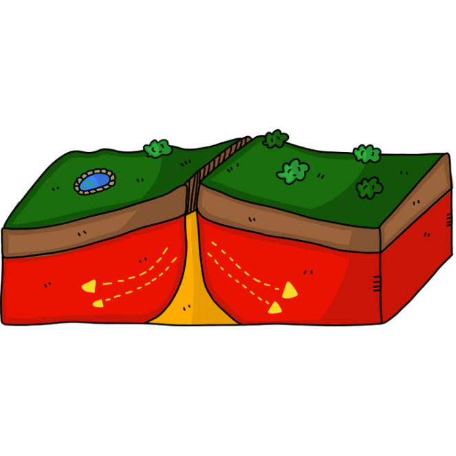
Tectonic plates float on the lower mantle’s molten rocks. Tectonics move as a result of movement on the molten rocks plate.
Tectonic plates movement types
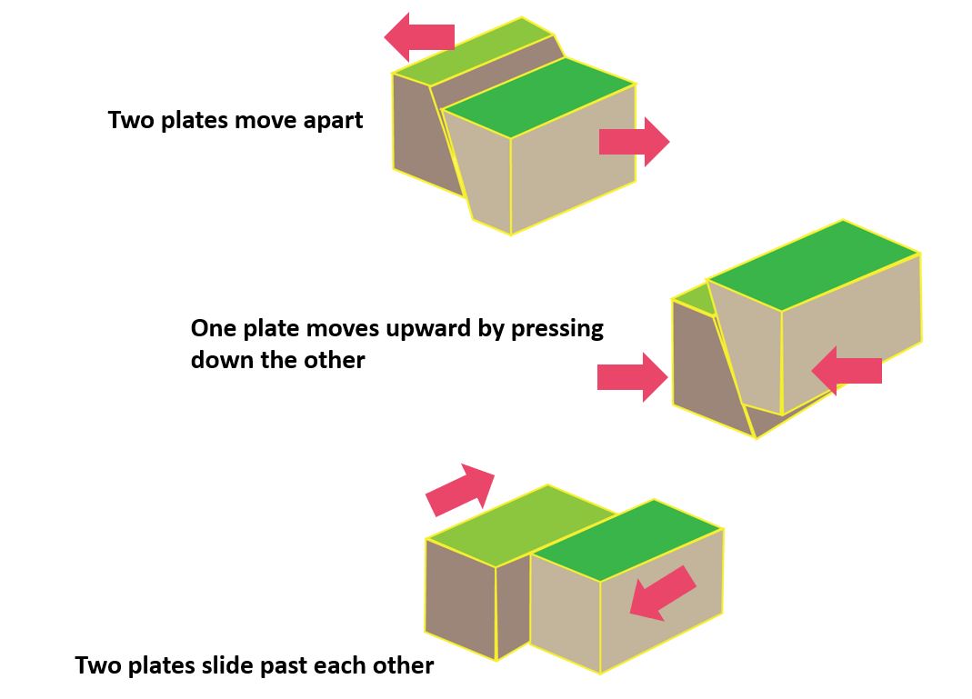
There are three methods in which the tectonic plates move with regard to one another.
- Two plates move apart. As a result, a deep gulf may form.
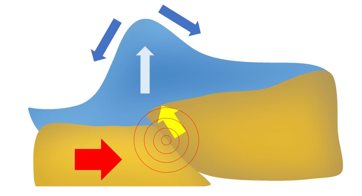
- One plate moves upward by pressing down the other. An earthquake may form.
- Two plates slide past each other. Earthquakes could occur.
Identify the tectonic plate features in the image.
When tectonic plates collide
When an oceanic plate collides with a continental plate, the denser oceanic plate is forced beneath the continental plate in a process called subduction. This creates a convergent boundary, and the subduction of the oceanic plate creates a deep ocean trench and can cause volcanic activity on the overriding continental plate. The collision and subduction can also cause intense pressure and friction, leading to the formation of mountain ranges, such as the Andes in South America and the Cascades in North America.
When two continental plates collide, the crust crumples and thickens, resulting in the formation of mountain ranges, such as the Himalayas in Asia.
An island arc or volcanic island chain, like the Aleutian Islands in Alaska or the Japanese Islands, can occur when one oceanic plate is thrust beneath another during a collision between two oceanic plates, creating a subduction zone.
The collision of tectonic plates is a driving force behind numerous geological processes, such as mountain range building, volcanic activity, earthquakes, and the generation of new crust through seafloor spreading.
When tectonic plates move apart
Divergent boundaries are formed when tectonic plates move apart. Magma emerges from the mantle at these boundaries and fills the gap between the plates, forming new crust. When this occurs in the oceanic crust, it is referred to as seafloor spreading, and it results in the formation of a new ocean floor.
As the two plates move away from each other, the magma cools and solidifies to form new crust. The new crust that is created is pushed away from the divergent boundary and toward the edges of the plates. Over time, this can create a feature known as a mid-ocean ridge, which is a long, underwater mountain range that forms along the boundary between two diverging plates. The mid-ocean ridge system is the longest mountain range on Earth, stretching for over 60,000 kilometers (37,000 miles).
In some cases, divergent boundaries can also occur on land, as is the case with the East African Rift Valley. As the plates move apart, the crust stretches and thins, creating a series of parallel faults and fissures in the Earth’s surface. Over time, this can lead to the formation of a new ocean basin or the separation of a continent into two or more pieces.
When tectonic plates push with each other
When tectonic plates push against each other, they generate a convergent border, which can result in the construction of mountain ranges, volcanic activity, and earthquakes.
There are three types of convergent boundaries, depending on the types of plates that are colliding. When an oceanic plate collides with a continental plate, the denser oceanic plate is forced beneath the continental plate in a process called subduction. This creates a deep ocean trench and can cause volcanic activity on the overriding continental plate. The collision and subduction can also cause intense pressure and friction, leading to the formation of mountain ranges, such as the Andes in South America and the Cascades in North America and Himalayas in Asia.
Subduction zones develop when one tectonic plate is pushed beneath another during a collision between two oceanic plates, which can result in the construction of an island arc or volcanic island chain like the Aleutian Islands in Alaska or the Japanese Islands.
At convergent boundaries, the movement of the tectonic plates can create intense pressure and friction, which can lead to the buildup of energy and result in earthquakes.
When tectonic plates slide past another
When tectonic plates slide past each other, it creates a transform boundary, where the two plates are moving horizontally in opposite directions along a fault zone. Transform boundaries are typically characterized by a lot of seismic activity, as the movement of the plates causes intense pressure and friction, which can lead to the buildup of energy and result in earthquakes.
One of the most well-known examples of a transform boundary is the San Andreas Fault in California, where the Pacific Plate and the North American Plate are sliding past each other. The movement of these plates has resulted in a number of large earthquakes, including the 1906 San Francisco earthquake.
Transform boundaries do not typically lead to the formation of mountains or volcanic activity, but they can still have a significant impact on the Earth’s surface.
When tectonic plates shift
Tectonic plates are in a constant state of motion and are always shifting, as they are driven by forces within the Earth’s mantle. When tectonic plates shift, it can result in earthquakes, volcanic activity, and other geological phenomena.
The movement of tectonic plates can occur at different types of plate boundaries, including divergent, convergent, and transform boundaries. At divergent boundaries, the plates move apart from each other, creating new crust as magma rises up from the mantle and solidifies. Plates move towards each other along convergent borders, with one plate often being forced beneath the other, resulting in subduction and the creation of mountain ranges and volcanic activity. The plates move horizontally past each other at transform boundaries, causing severe friction and pressure that can cause earthquakes.
When tectonic plates shift, they release energy in the form of seismic waves, which can cause the ground to shake and result in earthquakes. The severity of the earthquake depends on a number of factors, including the size of the tectonic shift, the distance from the epicenter of the earthquake, and the type of rock and soil in the affected area.
How tectonic plates cause tsunamis
Tectonic plates cause earthquakes because they are constantly moving and interacting with each other along their boundaries. When two plates come together, they can either slide past each other, move away from each other, or collide with each other. These interactions can cause a buildup of stress and pressure within the rocks at the plate boundary.
When the stress and pressure become too great, the rocks suddenly break, causing an earthquake. The energy released during an earthquake travels through the Earth in the form of seismic waves, which can be detected and measured by seismometers.
Earthquakes are most common along plate boundaries, especially at the boundaries where two plates are colliding or sliding past each other. These areas are known as fault zones, and they can produce earthquakes of various magnitudes, depending on the amount of stress and energy buildup. Strong earthquakes can cause significant damage and loss of life, making it important to understand the causes and mechanics of plate tectonics.
In 2004, Tsunami brought severe destruction to the coastal areas of Sri Lanka. This happened because of an earthquake occurred near the Sumatra Island due to collision of tectonic plates.
How tectonic plates cause earthquakes
Tectonic plate boundaries are the most typical locations for earthquakes, especially in areas where two plates clash or move past each other. These areas are referred to as fault zones, and depending on the amount of stress and energy that has accumulated, earthquakes of varied magnitudes can be triggered by them. Understanding the origins of and the mechanisms behind plate tectonics is essential because powerful earthquakes can cause significant property damage and even loss of life.
What causes tectonic plates to move?
Tectonic plates are moved by convection currents in the Earth’s mantle. The mantle is a layer of hot, semi-solid rock that lies beneath the Earth’s crust. As this material heats up and cools down, it circulates in convection currents, which cause the tectonic plates above it to move.
When hot magma rises to the surface and cools, it creates new crust, which pushes the existing crust away from the mid-ocean ridges. The movement of these plates is slow, averaging a few centimeters per year, but over millions of years, it has resulted in the formation of new continents, the opening and closing of oceans, and the creation of mountain ranges.
Other factors can also influence plate movement, including the weight and distribution of the continents and the shape of the ocean basins. However, the primary driving force behind plate tectonics is the convection of heat in the Earth’s mantle.
How fast do tectonic plates move?
Tectonic plates move very slowly. Tectonic plates move at a rate of a few centimeters per year, which may seem slow on a human timescale but over millions of years, this movement has led to significant changes in the Earth’s geography. The exact speed of plate movement varies depending on the specific plate and the location of the plate boundary.
For example, the fastest-moving plate is the Pacific Plate, which is moving at a rate of approximately 8-9 centimeters per year. In contrast, the North American Plate is moving at a rate of around 2.3 centimeters per year.
Additionally, some plates may move in different directions or at different speeds at different points along their boundary. Scientists study plate movements using a variety of tools, including GPS and satellite data, to track the movement of the plates over time.
Are tectonic plates constantly moving?
Yes, tectonic plates are constantly moving. They move very slowly, at a rate of a few centimeters per year, but their movement is continuous and ongoing. This movement is driven by convection currents in the Earth’s mantle, which cause the plates to either move away from each other, move towards each other, or slide past each other along their boundaries.
The movement of tectonic plates has shaped the Earth’s geography over millions of years, and it continues to do so today. The slow and steady motion of the plates can cause earthquakes, volcanic eruptions, and the formation of mountain ranges, among other geological phenomena. The study of plate tectonics is essential to understanding how the Earth’s crust has evolved over time and how it continues to change.
Can tectonic plates break?
Yes, tectonic plates can break. In fact, the boundary between two tectonic plates is often a zone of weakness where the plates are more likely to fracture and break. If the amount of pressure and stress that exists between two plates gets to be too significant, the rock that is located at the boundary between the plates may crack or slip, which will result in an earthquake.
The breaking of tectonic plates can also result in the formation of a new plate boundary or the widening of an existing one. This process is known as plate divergence or rifting and occurs when a section of the Earth’s crust pulls apart, creating a rift valley. As the plates continue to move, magma can rise up from the mantle, solidify, and create new crust, effectively creating a new plate boundary.
Will tectonic plates stop moving
It is unlikely that tectonic plates will ever stop moving, at least not in the foreseeable future. The movement of tectonic plates is driven by the slow convection of heat in the Earth’s mantle, which is a natural and ongoing process that has been occurring for billions of years. While the rate and direction of plate movement can change over time, the underlying forces that drive plate tectonics are expected to continue into the future.
However, it’s worth noting that the movement of tectonic plates is not constant and can be influenced by a variety of factors, including changes in the Earth’s climate, the distribution of continents, and shape of ocean basins. These factors can affect the speed and direction of plate movement, but they are unlikely to bring it to a complete stop.
Tectonic plates Syria and turkey
Syria and Turkey are located in a region where several tectonic plates meet, making it a seismically active area with a history of earthquakes and other geological activity.
The Arabian Plate borders Syria to the south, while the Anatolian Plate forms much of the Turkish landmass. The boundary between these two plates is a complex zone of active deformation that includes the East Anatolian Fault Zone, which runs through eastern Turkey and into northern Syria.
This region has experienced several major earthquakes in the past, including the devastating earthquake in eastern Turkey in 2011 that resulted in thousands of deaths and widespread damage. The area is still considered to be at high risk of earthquakes, and ongoing seismic activity and monitoring are important for assessing and mitigating the risks associated with these geological events.
Syria and Turkey earthquake
There have been several earthquakes in Syria and Turkey in recent years. Here are some notable examples:
In January 2018, a magnitude 6.2 earthquake struck near the border of Turkey and Syria, causing some damage and injuries in both countries.
In October 2019, a magnitude 6.6 earthquake struck near the city of Izmir in western Turkey, causing widespread damage and at least 115 deaths.
In March 2020, a magnitude 5.7 earthquake struck near the city of Van in eastern Turkey, causing some damage and injuries.
In January 2021, a magnitude 4.4 earthquake struck near the city of Gaziantep in southern Turkey, causing some damage and injuries.
The region around Syria and Turkey is seismically active due to its location near the boundary between the African Plate and the Eurasian Plate, which is part of the larger complex of tectonic plate boundaries around the Mediterranean Sea.
Syria earthquake – 2023
On February 6th, there was a series of powerful earthquakes that affected the border between Turkey and Syria. The first and most intense earthquake measured 7.8 on the Richter scale.
It has been years since this part of the world has been shaken by an earthquake of this magnitude.
Destruction occurred shortly thereafter as aftershocks slammed the area.
After that, in the afternoon, a second earthquake with a magnitude of 7.5 occurred, which was then followed by its own series of aftershocks. As a direct result of their actions, a humanitarian and economic crisis ensued. The deaths of thousands of people have been verified, but the whereabouts of many others still missing.
Look beneath the surface, where three tectonic plates collide, to understand why. When tectonic plates collide, a distinct and possibly destructive type of earthquake occurs. The first earthquake happened here, 11 kilometers beneath Gazientep, Turkey. Although 11 miles may appear to be a big distance for a strong earthquake, it is actually relatively short. The town is especially vulnerable because it is located near the meeting point of two tectonic plates. Tectonic plates are massive slabs of rock on the Earth’s crust that range in thickness from 10 to 160 miles and move slowly.
The Earth is divided into many massive plates that move around one other, with most earthquakes occurring around the plates’ boundaries. This is referred to as the Anatolia tectonic plate. It is essentially a microplate due to its small size and steady pressure. The Arabia plate is pressing up against the Eurasia plate, causing this. This pressure is forcing the Anatolia plate westward, where it will encounter considerably more friction from the rising Africa plate. The Anatolian microplate is caught in a vise between the Arabian and Eurasian plates, and as a result of that motion, this small plate is being pushed aside. As a result, the boundary between the Anatolia plate and the Africa and Arabia plates are attempting to collide as Anatolia moves west and Africa and Arabia move east. These boundaries are known as strike-slip faults, and they slip when friction between the plates builds up as they are pushed in opposite directions until it becomes too much. That’s a strike-slip earthquake. In a large earthquake, the strain will mount until it ruptures and releases all of the accumulated strain. That is what occurred in Gazientep, resulting in the 7.8 magnitude earthquake.
Tectonic plates Virginia
Virginia is located in the eastern part of North America, which is far from the major tectonic plate boundaries. However, there are still tectonic plates present in the region, although they are relatively inactive compared to other parts of the world.
The North American Plate covers most of the eastern United States, including Virginia, and is bounded by several other plates, including the Eurasian Plate to the east and the Caribbean Plate to the south. While there are no active plate boundaries in Virginia, the area has experienced several earthquakes in the past, most of which are associated with the ancient faults and fractures in the Earth’s crust.
The Central Virginia Seismic Zone is a zone of high seismic activity in Virginia that includes the city of Richmond and associated regions. Seismic activity in this region is assumed to be related to old fault systems and is modest in comparison to other seismically active areas. Geologists and seismologists are still attentively monitoring the area to better understand the dangers and potential hazards linked with this seismic activity.
Tectonic plates Florida
The state of Florida is in the southeast of the United States. It is not located at a tectonic plate boundary. Instead, Florida is on the North American Plate, which is a large tectonic plate that covers most of North America.
While Florida is not near any active plate boundaries, the state can still experience earthquakes. However, these earthquakes are relatively rare and are generally associated with minor faults and fractures in the Earth’s crust. The earthquakes that occur in Florida are usually small in magnitude and are unlikely to cause significant damage.
Florida is also known for its sinkholes, which occur when the limestone bedrock beneath the surface dissolves and causes the ground to collapse. While sinkholes are not directly related to plate tectonics, they are a result of the geology of the region and can cause significant damage to infrastructure and property.
Tectonic plates near California
Florida lies in the southeastern United States and it is located on the North American Plate, a vast tectonic plate that spans the majority of North America.
While Florida is not near any active plate boundaries, the state can still experience earthquakes. However, these earthquakes are relatively rare and are generally associated with minor faults and fractures in the Earth’s crust. The earthquakes that occur in Florida are usually small in magnitude and are unlikely to cause significant damage.
Florida is also known for its sinkholes, which occur when the limestone bedrock beneath the surface dissolves and causes the ground to collapse. While sinkholes are not directly related to plate tectonics, they are a result of the geology of the region and can cause significant damage to infrastructure and property.
Tectonic plates near Hawaii
Hawaii is located in the middle of the Pacific Plate, which is one of the largest tectonic plates on Earth. The closest tectonic plate boundary to Hawaii is the East Pacific Rise, which is located to the east of the Hawaiian Islands.
The East Pacific Rise is a divergent plate boundary, where the Pacific Plate is moving away from the neighboring Nazca Plate and Cocos Plate. This boundary is associated with volcanic and seismic activity, and it is responsible for the formation of new oceanic crust.
Hawaii, on the other hand, is a volcanic island chain that is not directly located on a tectonic plate boundary. Instead, it is located over a “hot spot” in the Earth’s mantle, where magma from the mantle rises up and forms volcanoes.
The motion of the Pacific Plate over the hot spot has created a chain of volcanic islands that extends for thousands of miles across the Pacific Ocean, with the youngest islands forming in the southeast and the oldest in the northwest. The volcanic activity in Hawaii is therefore not directly related to tectonic plate movement but is instead a result of the complex dynamics of the Earth’s mantle.
Tectonic plates near Japan
Japan is located at the junction of many tectonic plates, making it one of the world’s most seismically active regions. The country lies along the Pacific Ring of Fire, a zone of strong seismic and volcanic activity that encircles the Pacific Ocean.
To the east of Japan, the Pacific Plate is subducting beneath the North American Plate, the Eurasian Plate, and the Philippine Sea Plate. This subduction zone is responsible for many large earthquakes and tsunamis in Japan’s history, including the devastating 2011 Tohoku earthquake and tsunami.
To the west of Japan, the Philippine Sea Plate is subducting beneath the Eurasian Plate. This subduction zone is associated with volcanic activity and has created the volcanic arc that runs through Japan. The Izu-Bonin-Mariana Trench, which is the deepest part of the Pacific Ocean, is also located to the south of Japan and is a result of the subduction of the Pacific Plate beneath the Philippine Sea Plate.
In addition to these tectonic plates, the Okhotsk Plate is located to the north of Japan, and the Amur Plate is located to the west. While these plates are not directly involved in the subduction processes that occur around Japan, they can still affect the seismic activity in the region.
Tectonic plates near Indonesia
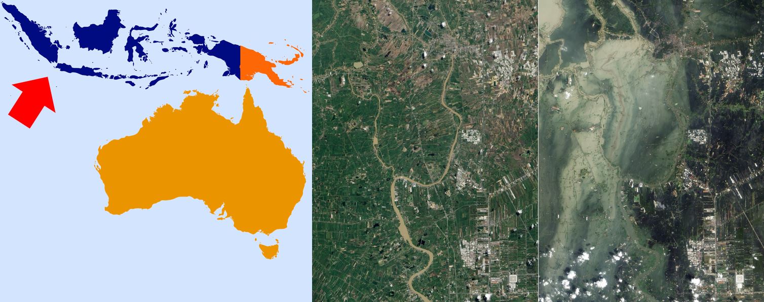
To the west of Indonesia, the Eurasian Plate and the Australian Plate meet along a complex boundary that includes the Sunda Trench, the Java Trench, and the Sumatra Fault. The subduction of the Indo-Australian Plate beneath the Eurasian Plate and the formation of volcanic arcs are responsible for many of the large earthquakes and volcanic eruptions that occur in Indonesia. The 2004 Indian Ocean earthquake and tsunami, which was one of the deadliest natural disasters in recorded history, was caused by the subduction of the Indo-Australian Plate beneath the Eurasian Plate off the coast of Sumatra.
To the east of Indonesia, the Pacific Plate and the Philippine Sea Plate meet along the Halmahera Trench. The subduction of the Pacific Plate beneath the Philippine Sea Plate has created a volcanic arc that includes the islands of Halmahera, Ternate, and Tidore.
Aside from these tectonic plates, the Banda Sea is located to the south of Indonesia, and the Molucca Sea is located to the north. These plates are also involved in Indonesia’s diverse tectonic processes, contributing to the region’s high levels of volcanic and earthquake activities.
Tectonic plates near San Francisco
San Francisco is situated on the tectonic boundary of two large plates, the Pacific Plate and the North American Plate. The San Andreas Fault, a transform boundary that runs through California and is responsible for numerous significant earthquakes in the region, is where these plates meet.
The Pacific Plate is moving to the northwest relative to the North American Plate at a rate of about 2 inches (5 cm) per year. As the plates move past each other along the San Andreas Fault, they create friction and stress that can build up and cause earthquakes.
The San Andreas Fault is part of a larger system of faults that includes the Hayward Fault to the east of San Francisco and the San Gregorio Fault to the west. These faults are also capable of producing large earthquakes and are closely monitored by seismologists. The geology of the area, which includes a mix of hard rocks and softer sedimentary deposits, also plays a role in the nature and severity of earthquakes that occur in the area.
What if earth has no tectonic plates
If Earth had no tectonic plates, its geology and landscape would be very different from what we see today. Tectonic plates are responsible for the movement of the Earth’s crust and the creation of many geological features, such as mountains, valleys, and ocean basins.
Without tectonic plates, there would be no subduction zones, which are regions where one tectonic plate is forced beneath another. This means that there would be no volcanic activity associated with subduction, and the Earth’s surface would have fewer volcanoes.
In addition, the absence of tectonic plates would mean that there would be no mountain-building processes, such as the collision of two continental plates that forms the Himalayas. This would result in a much flatter Earth, with fewer high-elevation regions.
The movement of tectonic plates also plays a crucial role in the Earth’s carbon cycle, as carbon is exchanged between the atmosphere, the oceans, and the solid Earth. Without tectonic plates, the Earth’s climate could be very different, as the carbon cycle would not function as it does now.
For a very long time, on the order of billions of years, tectonic action has been an essential part of Earth’s geology.
Tectonic plates vs plate tectonics
Tectonic plates and plate tectonics are related concepts, but they refer to slightly different aspects of the Earth’s geology.
Tectonic plates are large, rigid sections of the Earth’s crust that move and interact with each other. The Earth’s lithosphere, which includes the crust and the uppermost part of the mantle, is divided into a series of tectonic plates that float on the more fluid asthenosphere below. These plates move in response to the flow of the mantle, driven by processes such as convection and slab pull.
Plate tectonics, on the other hand, is the theory that explains how tectonic plates move and interact with each other. The plate tectonics theory is based on the idea that the Earth’s lithosphere is broken into a number of plates that move relative to each other. The theory describes the processes that drive plate movement, including the formation and destruction of oceanic crust, and the interaction between tectonic plates at different types of plate boundaries.
Tectonic plates vs continental plates
Tectonic plates refer to the large, rigid sections of the Earth’s lithosphere that move and interact with each other. Tectonic plates can be composed of both oceanic crust and continental crust, and they are defined by their boundaries, which can be divergent, convergent, or transform.
Continental plates, on the other hand, refer specifically to the large, thick pieces of continental crust that make up the Earth’s land masses. Continental plates are less dense than oceanic plates, and they are typically much older. Continental plates can also include portions of the oceanic crust that have been pushed up onto land through the process of tectonic uplift.
It is important to note that tectonic plates can include both continental and oceanic crust, and that the type of crust at a plate boundary can influence the type of tectonic activity that occurs. For example, when an oceanic plate converges with a continental plate, the denser oceanic plate is typically subducted beneath the lighter continental plate, creating a subduction zone and potentially leading to volcanic activity. When two continental plates converge, the result is typically mountain-building processes, as the two plates are too buoyant to be subducted.
Where do tectonic plates move during mid-ocean ridges?
Mid-ocean ridges are places where tectonic plates are diverging or moving away from each other. Mid-ocean ridges are underwater mountain ranges that run along the ocean floor and mark the boundaries between tectonic plates. As the plates move apart, magma from the mantle rises to fill the gap, solidifies and creates new oceanic crust. This process of creating new crust is called seafloor spreading, and it results in the widening of the ocean basin. Mid-ocean ridges are important features in the theory of plate tectonics because they provide evidence for the movement of tectonic plates and the creation of new oceanic crust.
Which components can be found in lithospheric plates?
Lithospheric plates can consist of both continental and oceanic crust, and the uppermost portion of the mantle. The continental crust is thicker, less dense, and typically older than the oceanic crust, which is thinner, denser, and generally younger. The mantle is the layer of the Earth beneath the crust, and it is composed of solid rock that is subject to convection currents that drive the movement of the tectonic plates. The lithosphere is the rigid, outermost layer of the Earth that includes both the crust and uppermost portion of the mantle, and it is broken up into several large plates that move and interact with each other. The movement of these plates is responsible for many geological phenomena, including earthquakes, volcanic activity, and the formation of mountain ranges.
